PART 3 - Requirements for a class UK2 Unmanned aircraft system
SI 2025/1106
Text in magenta in force from 1 January 2028
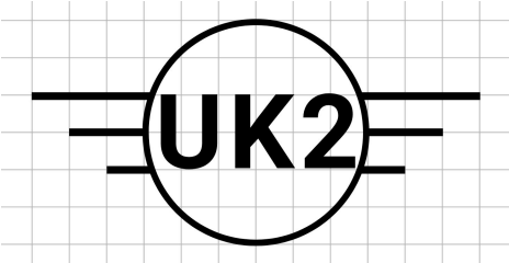
A class UK2 UAS bears the following class identification label on the UA:
A class UK2 UAS shall comply with the following:
(1) have an MTOM of less than 4 kg, including payload;
(2) have a maximum attainable height above the take-off point limited to 120 m or be equipped with a system that limits the height above the surface or above the take-off point to 120 m or to a value selectable by the remote pilot. If the value is selectable, clear information about the height of the UA above the surface or take-off point during flight shall be provided to the remote pilot;
(3) be safely controllable with regard to stability, manoeuvrability and the command and control link performance, by a remote pilot with adequate competency as defined in Implementing Regulation (EU) 2019/947 and following the manufacturer’s instructions, as necessary under all anticipated operating conditions including following the failure of one or, if appropriate, more systems;
(4) have the requisite mechanical strength for the UA, including any necessary safety factor, and, where appropriate, stability to withstand any stress to which it is subjected to during use without any breakage or deformation that might interfere with its safe flight;
(5) in the case of a tethered UA, have a tensile length of the tether that is less than 50 m and a mechanical strength that is no less than:
(a) for heavier-than-air aircraft, 10 times the weight of the aerodyne at maximum mass;
(b) for lighter-than-air aircraft, 4 times the force exerted by the combination of the maximum static thrust and the aerodynamic force of the maximum allowed wind speed in flight;
(6) be designed and constructed in such a way as to minimise injury to people during operation, sharp edges of the UA shall be avoided, unless technically unavoidable under good design and manufacturing practice; if equipped with propellers, the UA shall be designed in such a way as to limit any injury that may be inflicted by the propeller blades;
(7) unless tethered, in case of a loss of the command and control link, have a reliable and predictable method for the UA to recover the command and control link or, if it fails, terminate the flight in a way that reduces the effect on third parties in the air or on the ground;
(8) unless tethered, be equipped with a command and control link protected against unauthorised access to the command and control functions;
(9) unless it is a fixed-wing UA, be equipped with a low-speed mode selectable by the remote pilot and limiting the ground speed to no more than 3 m/s.
(10) unless it is a fixed-wing UA, have a guaranteed A-weighted sound power level LWA determined as per Part 13 not exceeding the levels established in Part 15;
(11) unless it is a fixed-wing UA, have the indication of the guaranteed A-weighted sound power level affixed on the UA and/or its packaging as per Part 14;
(12) be exclusively powered by electricity;
(13) have a unique serial number compliant with standard ANSI/CTA-2063-A-2019, Small Unmanned Aerial Systems Serial Numbers, 2019;
(14) have a direct remote identification that:
(a) allows the upload of the UAS operator registration number required in accordance with Article 14 of Implementing Regulation (EU) 2019/947 and any additional number provided by the registration system. The system shall perform a consistency check verifying the integrity of the full string provided to the UAS operator at the time of registration. In case of inconsistency, the UAS shall emit am error message to the UAS operator;
(b) ensures, in real time during the whole duration of the flight, the direct periodic broadcast from the UA using an open and documented transmission protocol, in a way that it can be received directly by existing mobile devices within the broadcasting range, of at least the following data:
i. the UAS operator registration number and the verification code provided by the CAA during the registration process, unless the consistency check defined in point (a) is not passed;
ii. the unique serial number of the UA compliant with point (13);
iii. the time stamp, the geographical position of the UA and its height above the surface or take-off point;
iv the route course measured clockwise from true north and ground speed of the UA;
v. the geographical position of the remote pilot or, if not available, the take-off point; and
vi. an indication of the emergency status of the UAS;
(c) reduces the ability of tampering the functionality of the direct remote identification system.
[Editorial note: New paragraph 14(A) will be inserted on 1 January 2028:
(14A) be capable of taking off only if the direct remote identification is functional and activated;]
(15) be equipped with a geo-awareness function that provides:
(a) an interface to load and update data containing information on relevant restricted areas, which ensures that the process of loading or updating such data does not degrade its integrity and validity, which ensures that the process of loading or updating of this data does not degrade its integrity and validity;
(b) a warning alert to the remote pilot when a potential breach of airspace limitations is detected; and
(c) information to the remote pilot on the UA’s status as well as a warning alert when its positioning or navigation systems cannot ensure the proper functioning of the geo-awareness function;
(16) if the UA has a function that limits its access to certain airspace areas or volumes, this function shall operate in such a manner that it interacts smoothly with the flight control system of the UA without adversely affecting flight safety; in addition, clear information shall be provided to the remote pilot when this function prevents the UA from entering these airspace areas or volumes;
(17) provide the remote pilot with clear warning when the battery of the UA or its command unit reaches a low level such that the remote pilot has sufficient time to safely land the UA;
(18) be equipped:
(a) with lights for the purpose of controllability of the UA; and
(b) with at least one green flashing light for the purpose of conspicuity of the UA at night to allow a person on the ground, to distinguish the UA from a manned aircraft;
(19) be placed on the market with manufacturer’s instructions providing:
(a) the characteristics of the UA including but not limited to the:
— class of the UA;
— UA mass (with a description of the reference configuration) and the maximum take-off mass (MTOM);
— general characteristics of allowed payloads in terms of mass, dimensions, interfaces with the UA and other possible restrictions;
— equipment and software to control the UA remotely;
— the procedures to upload the UAS operator registration number into the remote identification system
— reference of the transmission protocol used for the direct remote identification system emission;
— sound power level; and
— description of the behaviour of the UA in case of a loss of the command and control link, and the method to recover the command and control link of the UA; and
(b) clear operational instructions;
(c) the procedure to upload the airspace limitations into the geo-awareness function;
(d) maintenance instructions;
(e) troubleshooting procedures;
(f) operational limitations (including but not limited to meteorological conditions and day/night operations); and
(g) appropriate description of all the risks related to UAS operations;
(20) include an information notice published by the CAA providing the applicable limitations and obligations, in accordance with Implementing Regulation (EU) 2019/947;
(21) if equipped with a network remote identification system it shall:
(a) ensure, in real time during the whole duration of the flight, the transmission from the UA using an open and documented transmission protocol, in a way that it can be received through a network, of at least the following data;
i. the UAS operator registration number and the verification code provided by the CAA during the registration process unless the consistency check defined in point 14(a) is not passed;
ii. the unique serial number of the UA compliant with point (13);
iii. the time stamp, the geographical position of the UA and its height above the surface or take-off point;
iv. the route course measured clockwise from true north and ground speed of the UA;
v. the geographical position of the remote pilot or, if not available, the take-off point; and
vi. an indication of the emergency status of the UAS;
(b) reduce the ability of tampering the functionality of the direct remote identification system.